The FARA system includes a set of specially developed software that fully implements all the capabilities of the equipment, method, and helps to present the result in the form that is
optimal for the solution of the task.
Raw data reader
The program is designed to work with the surface receiver unit of the FARA
system and is its integral part.
Main features of the program:
• View the amplitude and phase of the signal for all frequencies in real time
• Monitoring of system operation parameters
• Data collection and saving as an internal format file
• Prompt view of current and saved data
Program for editing and control of field data
Main features of the program:
• View and edit data for each station
• Change of general measurement parameters
• Removing and cloning of stations
• Adding stations from external files
• Loading and viewing the transmitter's additional data
• Downhole units depths correction associated with cable stretching
• Monitoring of the receiver's depth counter malfunctions
• Comparison of signal strength values for reverse radiation directions
• Comparison of repeated measurements
• Export data in text format
Tomographic reconstruction program
The program is designed for tomographic reconstruction of electrophysical parameters of the cross-hole space according to the field data of the FARA system.
For processing, both the amplitude and phase parameters of the signal can be used.
In addition, the program has many features that enhance the quality and reliability of the result - such as noise reduction systems, a system for linking of two-sides measurements, a robust data rejection system etc.
For processing, both the amplitude and phase parameters of the signal can be used.
In addition, the program has many features that enhance the quality and reliability of the result - such as noise reduction systems, a system for linking of two-sides measurements, a robust data rejection system etc.
Modelling program
The program is designed to calculate the amplitude and phase characteristics of a signal corresponding to a given model of the cross-hole space.
The obtained data are subjected to a standard processing procedure, which makes it possible to evaluate the possibilities of using the FARA system to solve various problems.
The model is defined as an unlimited set of non-overlapping spheres of any diameter.
The obtained data are subjected to a standard processing procedure, which makes it possible to evaluate the possibilities of using the FARA system to solve various problems.
The model is defined as an unlimited set of non-overlapping spheres of any diameter.
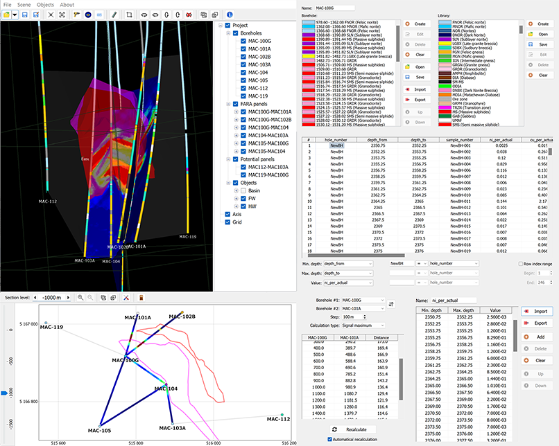
3D system
• Visualization of boreholes (inclinometry, geological
intervals, mineralization, etc.)
• Editing and visualization of FARA panels by different
frequencies
• Potential panels
• Horizontal sections
• Universal import-export
• Calculation of distances between boreholes
• Model data presentation
• Loading and presenting third-party 3D objects
and much more...
• The program runs on Microsoft Windows 7 and later
environments.
• Free for distribution and use (Freeware).
• Versions are 32 and 64 bit.
• Example attached.
Survey planner
Main features of the program:
• Automatic calculation of transmitter station depths
• Calculation of the transmitter travel range for each station
• Preparation of materials for the reading program
• Export as a document, file or QR code


